
Back in February I wrote about Hurricane Irma hitting during my 29th birthday, and I knew it would be a while before we got to 2022’s hurricane scare. I still have (more than) a few posts before getting to September 2022 in my current timeline, but with the release of the first cone for soon-to-be-named Helene and what that means for my week I thought I’d write about that week in September 2022 for funsies before I go into full storm anxiety mode.
(Also this is keeping me from arguing with nincompoops on Reddit who swear up and down that Ian hit Pensacola. No, silly goose, that was Sally in 2020. Get your Florida storm history straight.)
I sat down at my desk at work on a Wednesday morning in mid-September and went through my usual pre-work internet routine: College football subreddit, Ravelry, politics subreddit, the GFS model on the Tropical Tidbits site…
That GFS model stopped me in my tracks. I checked the Euro, which was outperforming the GFS in track that season but underperforming in intensity. Oh no, the Euro agrees… There was a good possibility a major hurricane would hit the west-central coast of Florida in a week’s time, right where I live, the part of Florida that has been my home my whole life.
But here’s the thing: Those were just models. The low pressure that would eventually be the center of Hurricane Ian had yet to even spin off from the Central American Gyre. There was nothing to track, just some data that was in pretty heavy agreement of a storm of some magnitude hitting somewhere between Tallahassee and Naples within the week. This was very different from Irma five years before. Irma was named very early on in the nearly 10 days of watching and tracking before landfall. This time, we wouldn’t have a center to track until maybe the Sunday before landfall, and model tracks are notoriously all over the place without a defined center low pressure in their data mix. I made a mental note to check my non-perishables when I got home that day, but outside of placing a Target pick-up order towards the end of the week, I tried my best to let it go. The week of nonsensical panic leading up to Irma left mental scars I don’t know if I’ll fully heal from. Coupled with the storm anxiety that already existed before Irma, I knew the best thing for me would be to make some silly quips on r/TropicalWeather (where I’m a well-known poster for Florida threats) and just let it go for a few days.
By the end of the week, we had a named storm, Ian, and a forecast track that shifted landfall north into the Big Bend area of Florida. It didn’t spare the Tampa Bay area from effects because storms that take that route side swipe the area with heavy bands and push water into storm surge prone areas, but it was better than a direct strike. I double-checked essentials if we lost power, but I continued to let it go for a few more days. The mid-week day off would be very welcome. Then, sitting on the artificial turf at the gym Sunday evening post-metcon, I checked the latest track. Oh no, oooooooohhhhh nooooo
A major hurricane was now officially forecast to hit the Tampa Bay area head-on in just a few days. The models were right all along. My worst nightmare was coming to life again…
Late Sunday, news started coming out about school and business closures. I still had to go into work on Monday, but I knew it was just to get everything prepped for the forecasted storm surge. My old office building was located in Zone A - the first places that get mandatory evacuation notices when storm surge heavy hurricanes threaten the area. Within a hour of being at work that day we received the official notice that we were closed for the rest of the week at a minimum. I couldn’t focus on anything at work that day, so I set up shop in r/TropicalWeather again, trying to do what I could to combat the “Lol Hurricane Phoenix” doomsday posters that come out in droves when any kind of storm threatens the Tampa area:
Louder for those in the back!
The amount of fretting and “we gotta let Tampa know they’re about to get slammed” the last couple of hours is ridiculous. We know! We’re in the cone. We’ve been in the cone this whole time. We’re prepping. We’re not stupid.
Stop hyper focusing on Tampa because it gives you your doomsday jollies. There are many, many places in the cone that are at just a high risk, if not higher, of severe effects.
Reddit wanted this to be Project Phoenix sooooo bad. Don’t get me wrong, this storm is going to suck A LOT. It’s going to cause a lot of damage wherever it ultimately makes landfall. Hell, right now I’m forecasted to get a cat 1-2 eyewall in suburban interior Hillsborough County and I’m terrified.
But it’s not going to be Project Phoenix. And certain group of users here are going to be so disappointed.
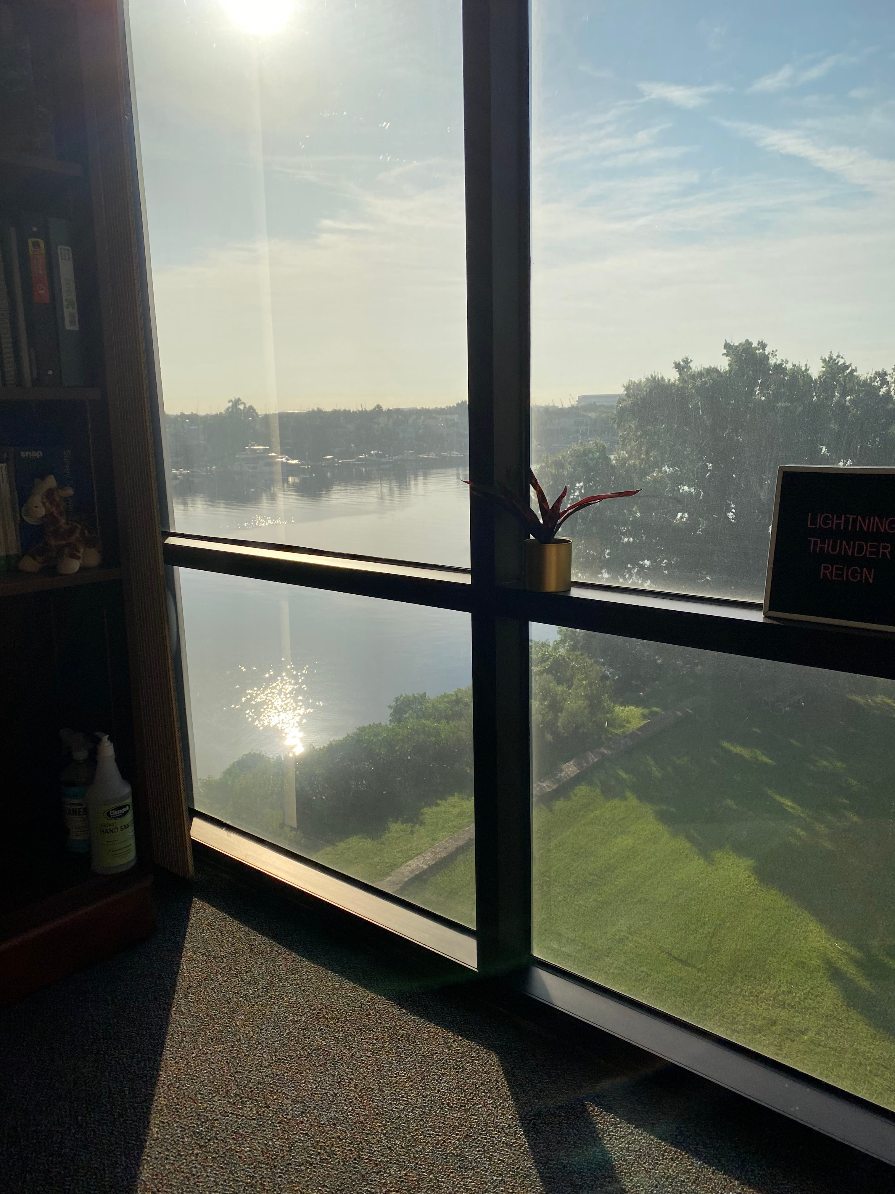
Trying to be a voice of reason in between panic and doomsday scenarios was the best thing I could do to soothe the anxiety building up in me. I was terrified for my hometown, my community. I looked outside my office window, at the river flowing into Tampa Bay. It looked picturesque outside, the kind of Florida day we all dream of in between the never-ending heat, oppressive humidity, and near-daily thunderstorms. I took a walk along the river on my lunch break that day and wondered if this was the last time I would see this neighborhood like this.
Late in the morning on Tuesday, less than 24 hours before the first effects from Ian would be felt, I laid on my couch watching the governor give a press briefing while diving into my first box of white cheddar cheez-its (my favorite hurricane snack) when I heard an official say Venice was the new landfall spot. My ears perked up — Venice is over an hour south of Tampa. The 5am track still had Tampa as landfall, but the 11am track would be out in 15 minutes. Maybe, maybe… I thought as I F5-ed the National Hurricane Center front page. State emergency management wouldn’t mess up that bad in a storm briefing, I told myself. I may have strong opinions about the Florida government, but I can also say the emergency management office (and DeSantis in general) know when it’s time to be serious. There is no legitimate way an official of that magnitude would misspeak with Venice, a smaller city 75 miles to the south, when Tampa Bay, with a two-county population of 2.4 million, was still the landfall target. Was this another Hurricane Charley situation?
Emergency management has access to information the general public doesn’t and gets information earlier. If the NHC knew by 9 it would shift the cone south with new information they had collected since the 5am advisory, then it’s not a bad idea to start getting the word out.
With Charley, a lot of places south of Tampa Bay were not prepared for a strike, even though they fell in the cone. This is why there has been less emphasis on a single track and more emphasis on cones and ensembles since 2004. Everyone in a cone should be prepared, and saying Venice (or even further south) gives those areas more time to be prepared so they aren’t caught off guard again. The Tampa area is prepared. Areas south should be prepared now too.
At 11am, the National Hurricane Center showed an updated track taking the center of Ian south of the Tampa Bay area. The immediate crisis was adverted, but Ian was large and my area was still forecasted to be in the outer eye wall with Category 2 winds. Not my idea of a good time, but it was better than getting a Category 4 or 5 head on.
I thought I would be brave enough to ride out Ian at my apartment, but early on Wednesday morning, with the forecast track still taking cat 2 winds over me, I made the decision to ride out the storm at my parents’ house. My husband was less than thrilled about my anxiety getting the better of me, but he didn’t fight the decision. I spent the day watching live coverage of Ian with my dad while my husband slept, and we returned to our apartment unscathed the next day. In hindsight, was staying in our place the better option? Yeah, probably. But sometimes I can’t reason with the storm anxiety part of my brain, no matter how much I want to. By Friday, we had the first open-door morning of fall that year, as the cold front that steered Ian’s center into Fort Meyers took hold on the area.
On Monday, I went back to my office in that picturesque neighborhood with a new sense of gratitude for what I have in my life. I was still glued to the news coming out of Fort Meyers and probably had a bout of survivor’s guilt going on, but I saw my hometown in a new light once the initial shock of what just happened settled.
I got to conquer my storm anxiety a year later when Idalia side-swiped Florida’s west coast before making landfall in the Big Bend, and it looks like I’ll get another chance later this week, assuming the Midwest cold front driving the steering currents later this week doesn’t come in faster than expected (which would drive the storm further eastward at a faster clip).
It feels like I question why I still live here at least once a year during hurricane season. I turned 16 during the infamous 2004 season, but then I didn’t have to deal with the threat of anything more than a tropical storm until 2016’s Hermine, which hit a week before my 28th birthday. I spent my 29th birthday anticipating a category 5 hurricane hitting my hometown the next year. Tropical storms came and went in the years that followed, but it took five years for Ian to make me really question why I stayed after Irma. Last year was Idalia (albeit no where near as bad mentally for me). Today, it’s soon-to-be Helene. Outside of the anomalous 2004 shitshow, I didn’t spend a lot of time worrying about hurricanes and their impact on where I live in my childhood and early adult years. I saw hurricanes do catastrophic levels of damage over those years, but my home was spared time and time again. I was even ready to give Irma a pass, another anomalous event that happened once every 15 years or so. But Ian, Idalia, Helene…three years in a row with varying threat levels that really make me take a pause and question how sustainable living here is.
I’m writing this on Monday, and by the time I go to bed tonight it might be a very different picture. Tomorrow will surely be different. When y’all get this in your inbox on Wednesday, it will also be different. I really don’t know how the next 72 hours will play out. At the time I’m writing this, I expect a very stormy Thursday, most likely a day off from work, but nothing we haven’t see before. I worry about the Big Bend again, who took Idalia head on 13 months ago, an area that is one of the last refuges of native wild Florida but also doesn’t have the infrastructure to weather major storms like this. I worry about Tallahassee and the majestic oaks that line every street there, my home away from home, the place I escape to when I just need a weekend away.
All I can say today, September 23rd, is that there will be a Pub Sub in my life later this week (our hurricane tradition). Everything else is left to chance.